Clearing the Way for the Future of Farming
Efficient, Accurate Rock Detection Services
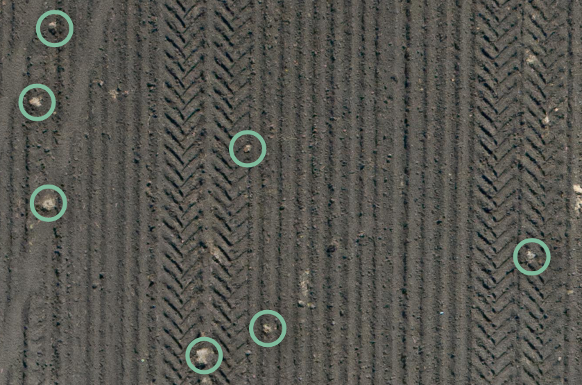
AI Rock Detection for Smarter Fields
RockPro combines drone technology with advanced computer vision to locate and map field debris—helping farmers save time, protect equipment, and increase yields.
🚀 See the Dashboard DemoSmarter Fields Start Here
RockPro combines AI, drones, and smart software to detect, map, and manage rocks in your field—down to the centimeter. Reduce damage. Save time. Get the job done smarter.
🚀 See the Dashboard in ActionKey Benefits of RockPro:

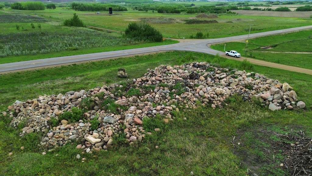
We Detect and Locate The Rocks For You
RockPro provides locations of rocks in your fields ahead of planting and harvest, quantifying the rock picking tasks.

Rock Picking Made Faster and More Accurate
RockPro speeds up rock picking and improves accuracy. Our service helps prevent equipment repairs and makes the best use of labour.
RockPro Connects With Your Preferred Tools
RockPro integrates with farm management systems and GPS devices, cost-effectively accelerating rock picking with the tools at hand.
Launching in Alberta
Spring 2025

Book early and save!
With Support From:
Frequently Asked Questions
How accurate is RockPro’s Rock Detection Service?
(Click to expand)
- How accurate is RockPro’s Rock Detection Service?
- Initial Accuracy: Our technology currently boasts an 80% accuracy rate, which we expect to exceed 95% by fall 2024 as we continue to refine our systems.
- How much does the RockPro service cost per acre?
- Promotional Price: For a limited time, our service is priced at $4/acre plus a callout fee.
- What is the turnaround time for receiving rock location data after the drone survey?
- Speed of Service: We deliver results within 24 hours of conducting the drone survey.
- Can RockPro detect rocks of all sizes?
- Detection Capability: Our service is optimized to detect and locate rocks that are football size (12 cm) or larger.
- How does RockPro integrate with different farm management systems and GPS devices?
- Integration Options: Depending on the platform, RockPro offers either direct integration or provides importable files.
- What kind of support does RockPro provide during and after the rock detection process?
- Support Provided: We ensure our service is effective for you by offering support during the rock detection process and guiding you through the rock-picking phase.
- Are there any subscription plans or discounts for long-term use?
- Subscription and Referral Programs: Yes, we are preparing to offer a subscription plan and a “Neighbour Referral” program for long-term customers.
- What regions does RockPro currently service?
- Service Areas: Currently, we are working with early adopters and testing partners in Southern Alberta and plan to expand to other rock-prone regions in Alberta by Spring 2025.
- How does RockPro handle data privacy and security?
- Privacy and Security: For detailed information, please refer to our privacy policy and contact us with any questions or concerns.
- Is there a trial or discount available for new customers?
- New Customer Offers: Yes, we offer trials and discounts for new customers. Please contact us for more details,we are looking forward to growing with you!
-
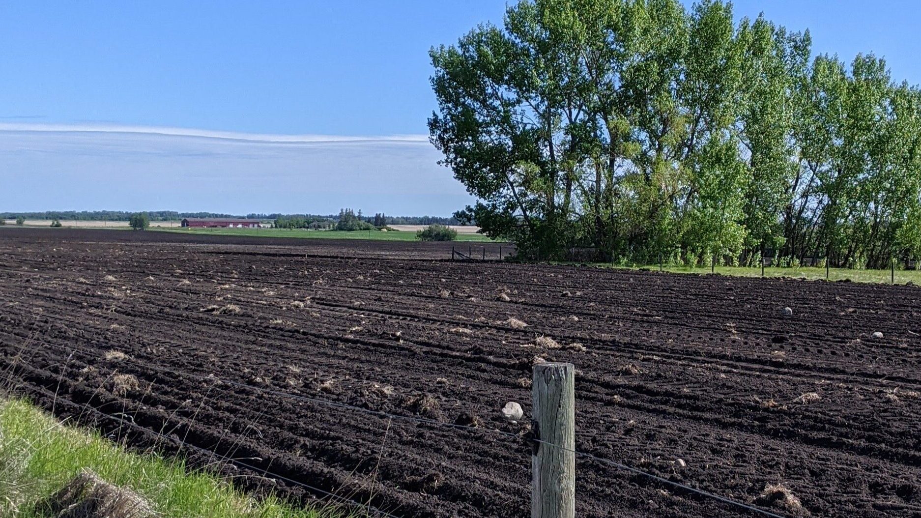
Since the advent of mechanized seeding and harvesting, reemerging field rocks have forced farmers to solve the problem rocks pose through the use of the generational practice of rock picking. The perennial challenge of rock picking in agriculture poses significant risks to equipment, time, and safety, especially under drought conditions. RockPro offers a practical solution,…
-
In partnership with Olds College and funded by NRC-IRAP, we undertook a key research project to validate our rock detection technology.